fix.bm
LiveCitizen problem-reporting for Bermuda. Photo, pin, submit. The right government department gets it without you needing to know which one.
Status
Live
Categories
0
Govt Groups
0
Based On
FixMyStreet
01
The Problem
Bermuda does not have a simple, public way for residents to report problems to the government. No central intake. No map. No way to see if someone else has already flagged the same broken railing or overflowing bin.
If you wanted to report a pothole, you had to figure out which ministry handles roads, find a phone number, call during business hours, and hope someone wrote it down. Most people just gave up.
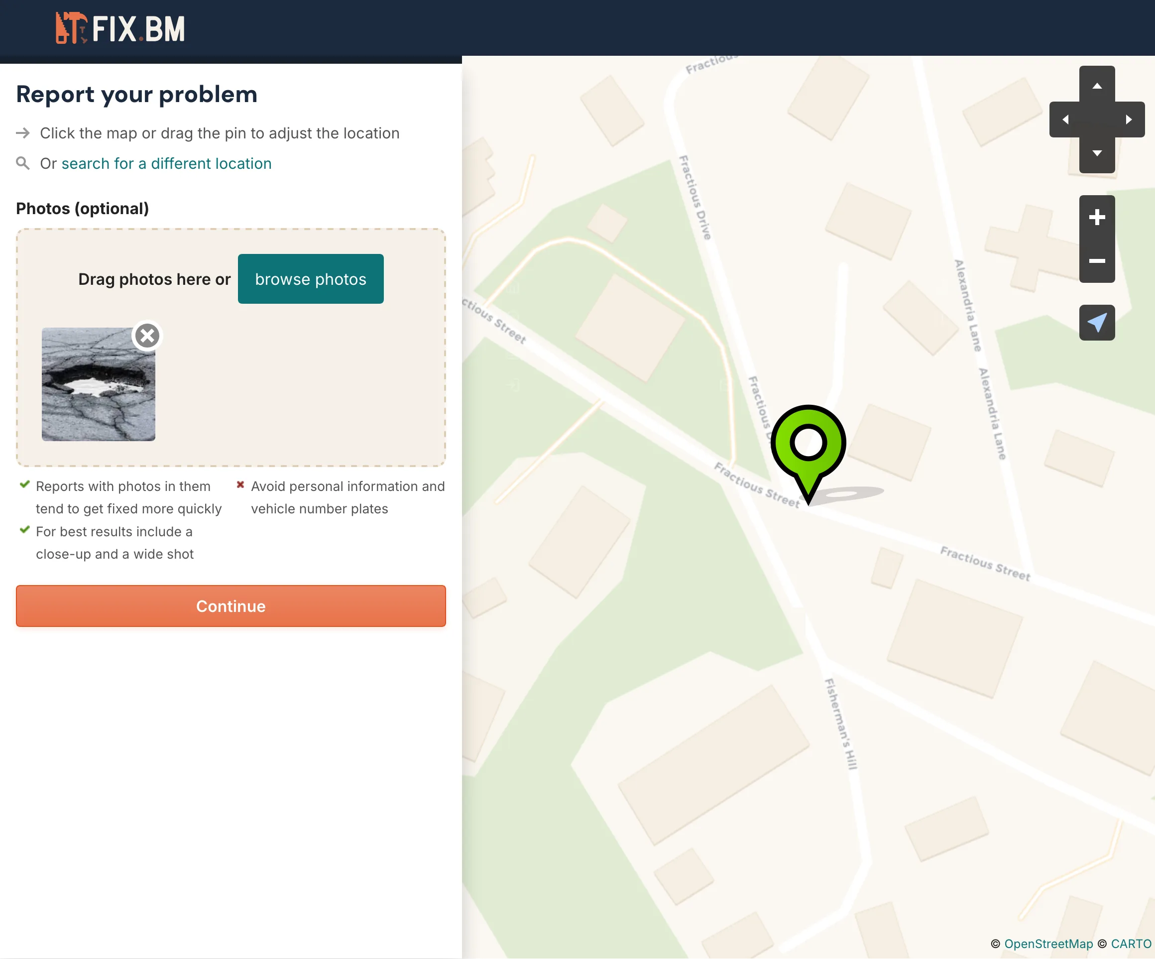
Reporting a problem - photo upload with automatic GPS pin
02
The Approach
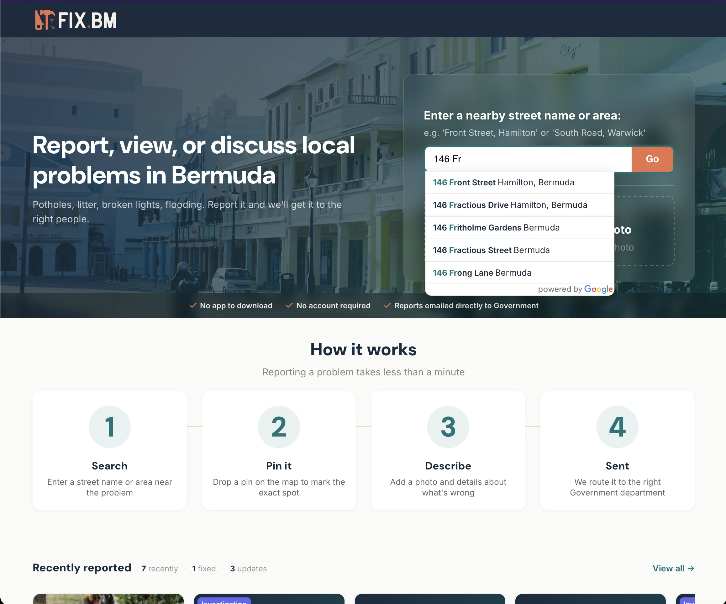
fix.bm is a cobrand of FixMyStreet, the open-source civic reporting platform built by mySociety in the UK. We deployed it, customized it for Bermuda's geography and government structure, and made reporting as frictionless as possible.
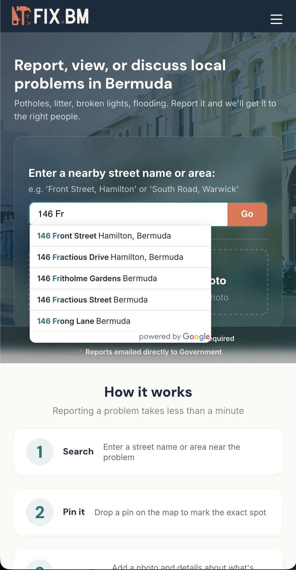
Photo-first with automatic location. Take a photo of the problem. If the image has GPS data in its EXIF metadata, fix.bm extracts the coordinates and drops the pin automatically. If not, search for the location or place the pin manually.
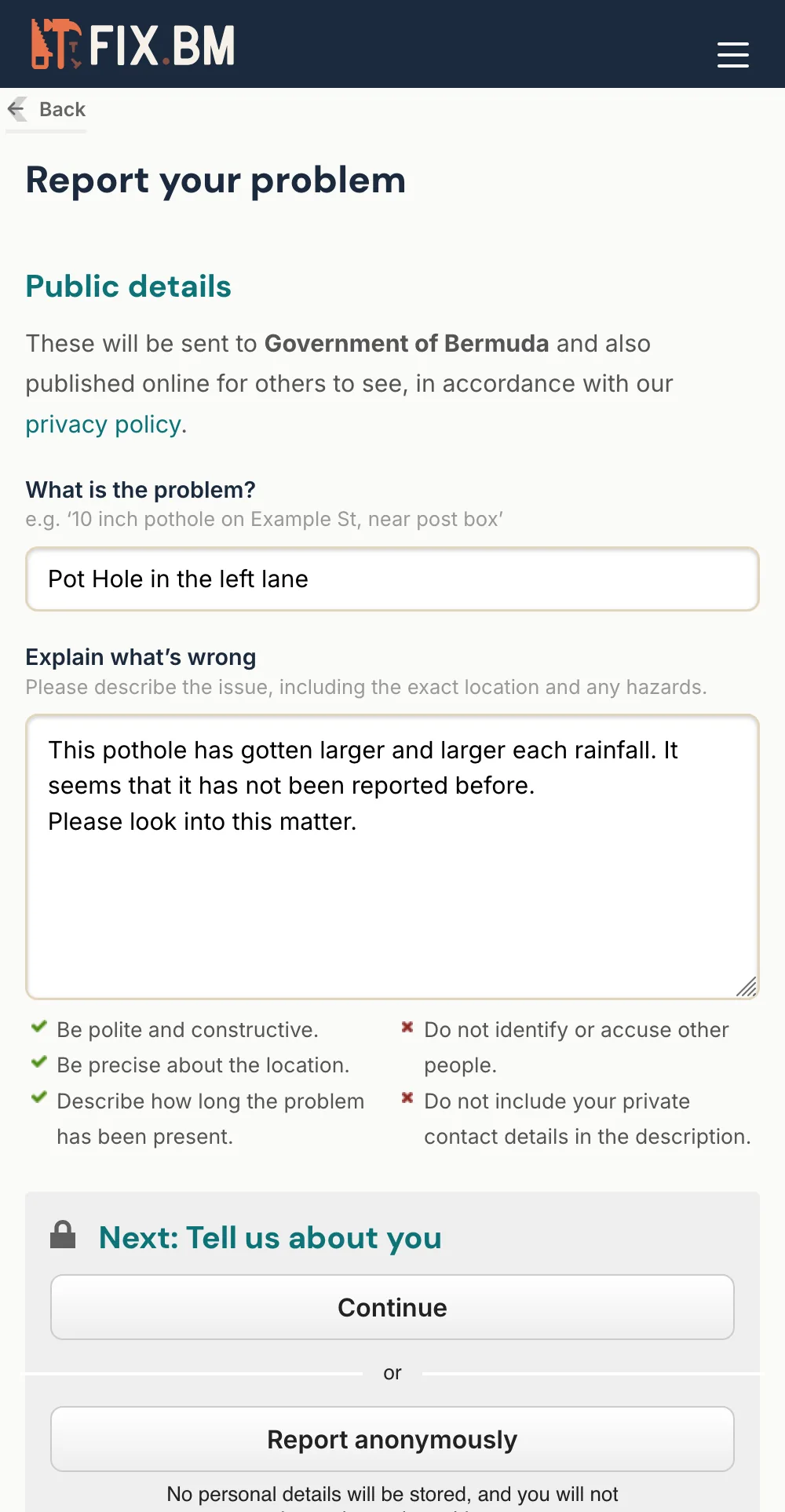
No account required. No email confirmation. Anonymous reporting is on by default. The fewer barriers, the more reports come in.
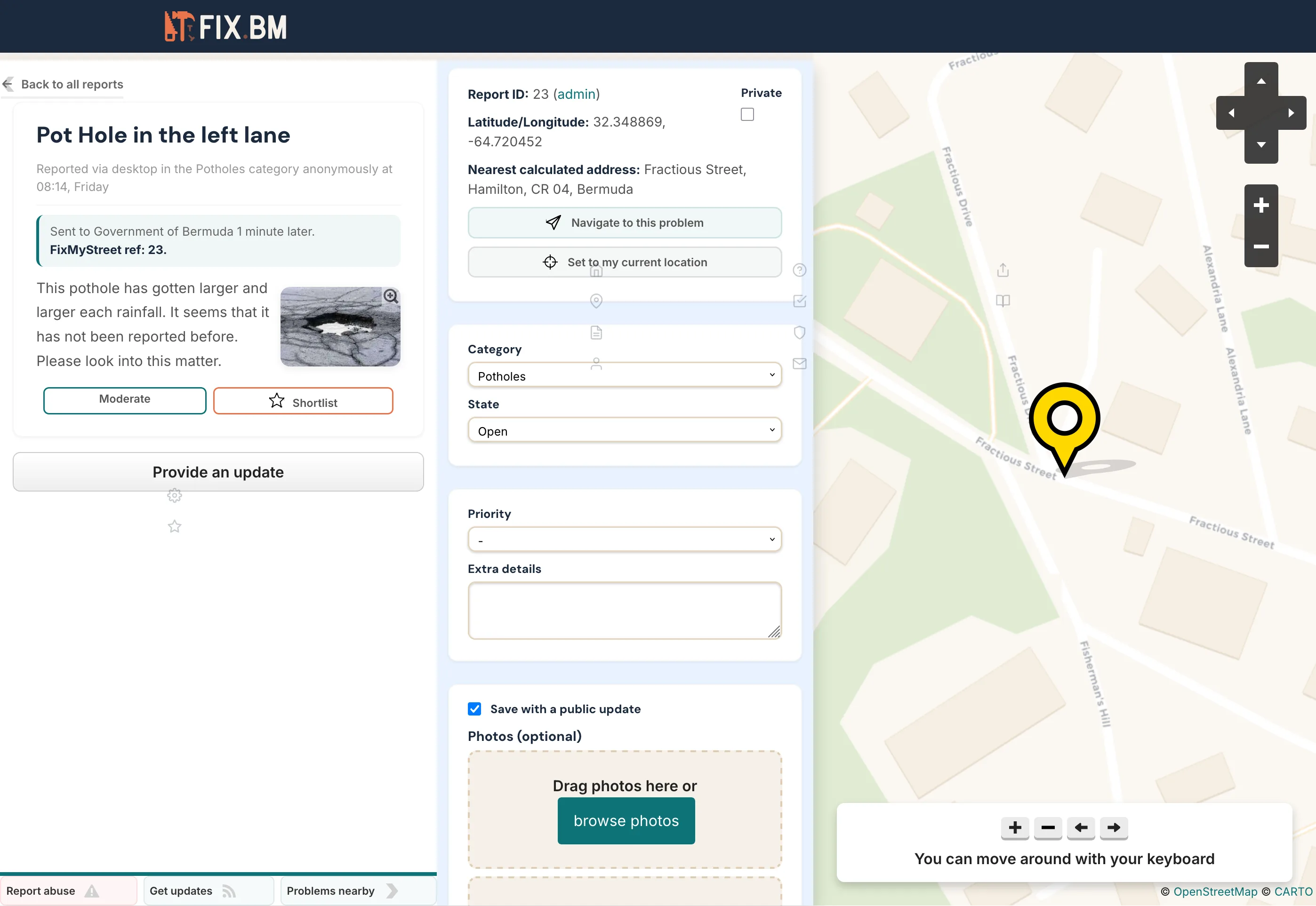
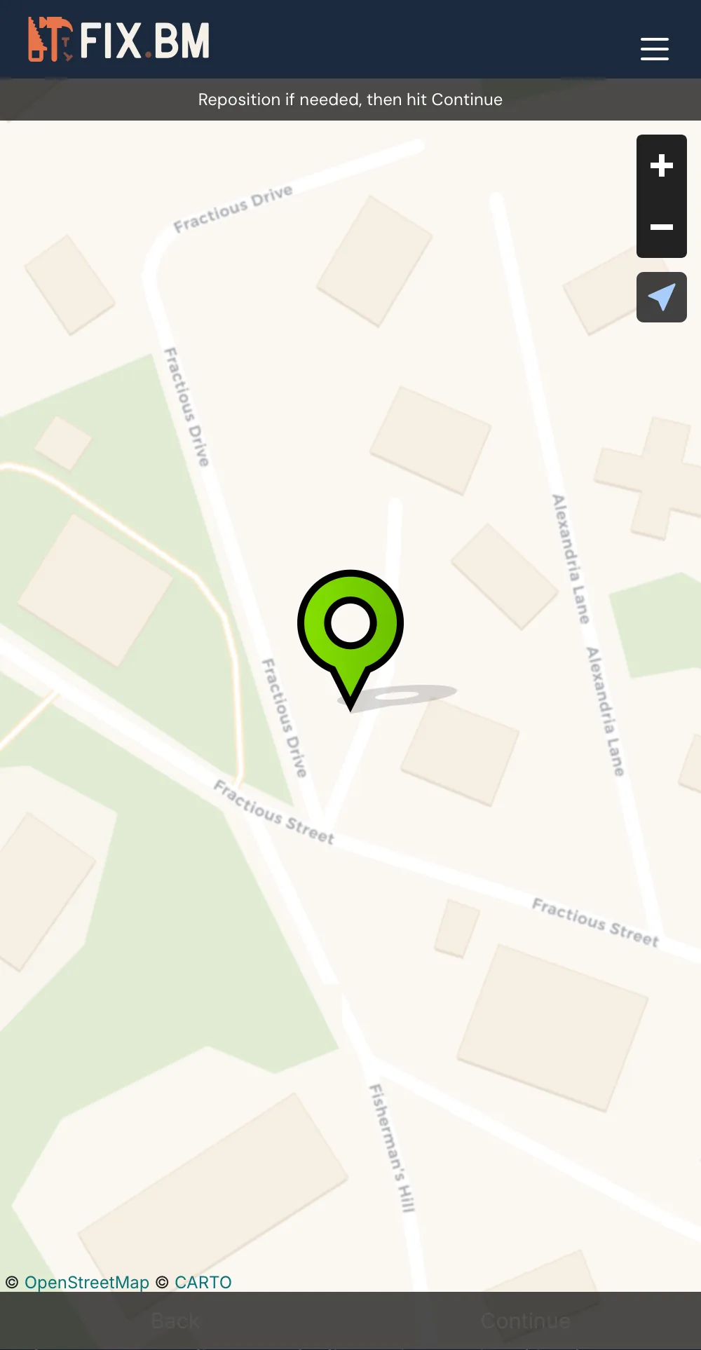
Viewing a reported problem with status and map location
03
How It Works
Reports route to the Government of Bermuda by category. There are 45 categories organized into nine groups: Roads and Highways, Transport, Parks and Environment, Waste Management, Environmental Health, Water and Sewage, Planning and Buildings, Emergency Services, and Other Government.
Each category maps to the relevant department's email inbox. When a report is submitted, the right people get it without the resident needing to know which ministry handles what.
Government staff access an admin panel to triage, update, and close reports. When a report's status changes, the person who filed it gets notified.
Technical stack: FixMyStreet (Perl/Catalyst), PostgreSQL, Docker, OpenStreetMap, Google Geocoder, mySociety MapIt, EXIF GPS extraction via client-side JS.
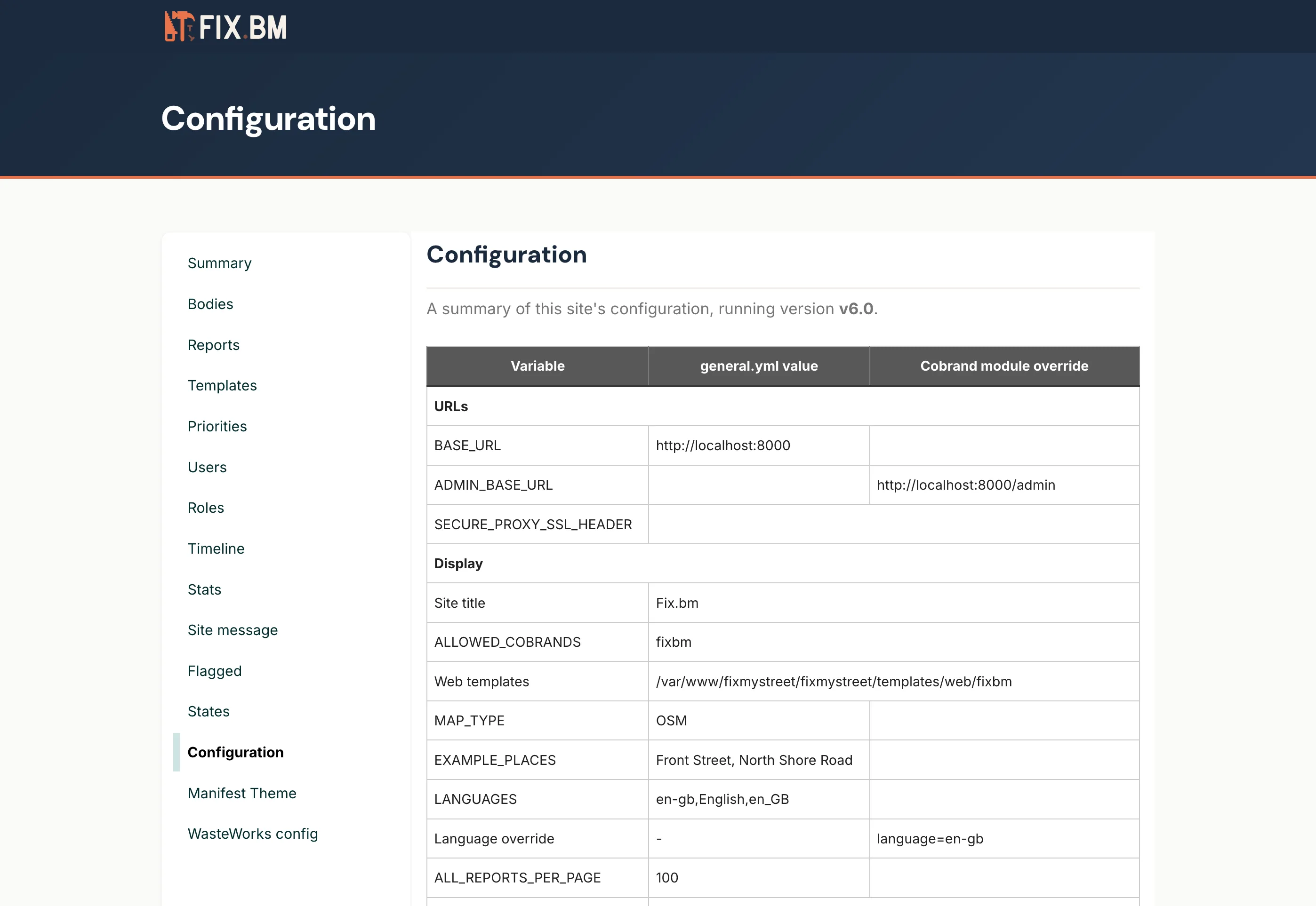
Government admin panel - category routing and configuration
04
The Result
Over time, fix.bm builds a public, searchable record of what has been reported and what has been addressed. It creates an accountability layer between citizens and government that did not exist before.
Every report is visible. Every response is tracked. The platform turns scattered complaints into structured data that both residents and government can act on.
Together with writethem.bm, fix.bm gives Bermudians two ways to engage with their government: report problems as they find them, and write directly to the people who represent them.